Organizations for people of color, betraying people of color

Updates

  1. Originally published, August 23, 2020, at 9:38 pm.
  2. August 24, 5:50 am:
    • But for the predicted lightning storms,[1] with matching development now appearing, the Walbridge Fire looks more and more like something in the rear view mirror. I have replaced the screenshot of the Sonoma County Fire Incident Map with one taken at 5:26 am and updated the satellite imagery.
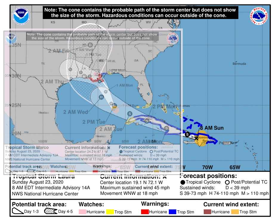
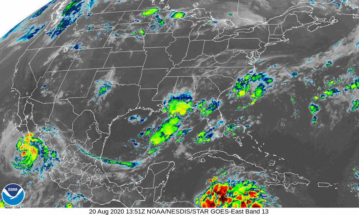
    • Similarly, I have updated the satellite imagery for the eastern U.S. and Gulf of Mexico. Marco appears to be making landfall in the Florida panhandle. Laura is now south of Cuba and looks to me like it could be caught in the same pattern that shifted Marco east. That pattern is itself shifting east so Laura would likely hit further east than Marco.

Ridesharing

It’s a sadly familiar story: Historically, some unions have been co-opted by employers, helping in their own emasculation, while union officials feather their own beds. Only this time, it’s organizations that should advocate for people of color, advocating California’s Proposition 22, arguing that ridesharing provides access to transportation and work for people of color. What they mean is that that work pays an estimated $5.64 per hour in California.[2]

These organizations ought to be ashamed of themselves. But hey, their beds are feathered.

Kim Bojórquez, “Why are Black and Latino advocacy groups backing Uber, Lyft in California labor law fight?” Sacramento Bee, August 23, 2020, https://www.sacbee.com/news/politics-government/capitol-alert/article244812707.html


Walbridge Fire

FireShot Capture 301 - County of Sonoma Fire Incident Map - sonomacounty.maps.arcgis.com.png
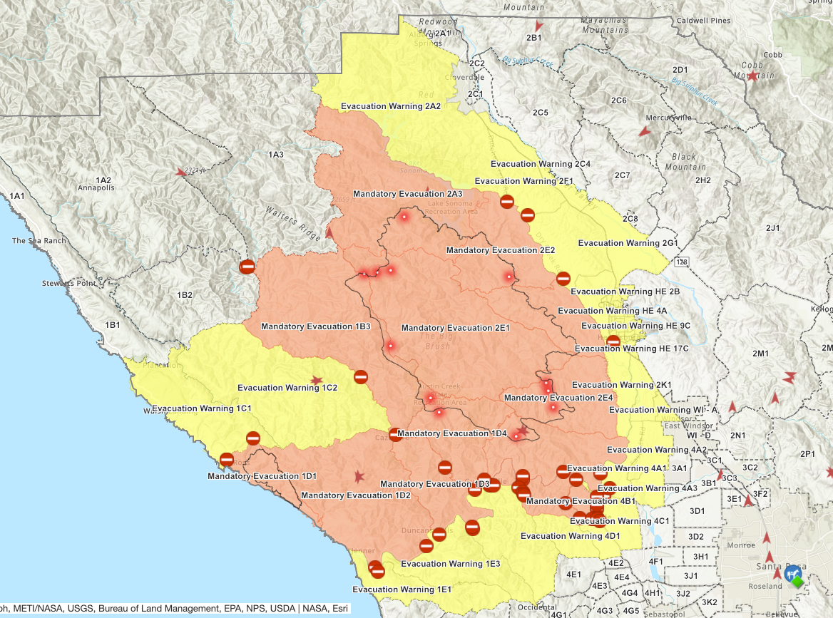
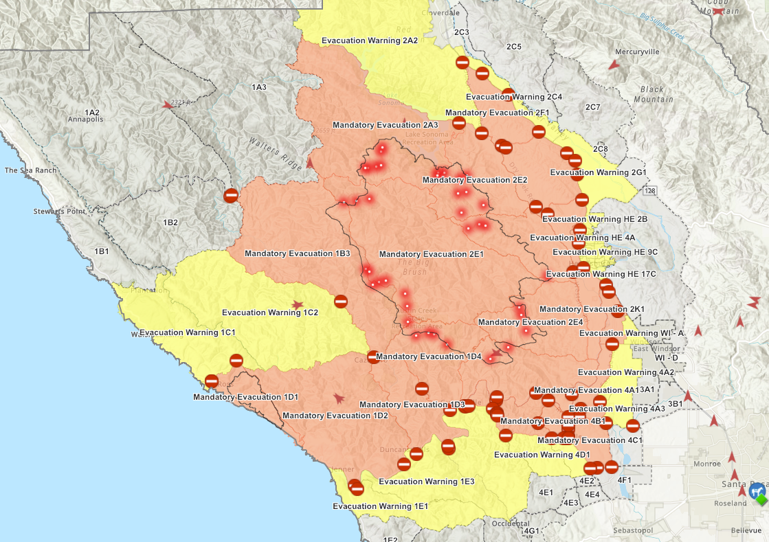
Fig. 1. Screenshot of Sonoma County Fire Incident Map, taken by author, August 23, 2020, 9:23 pm.

wus
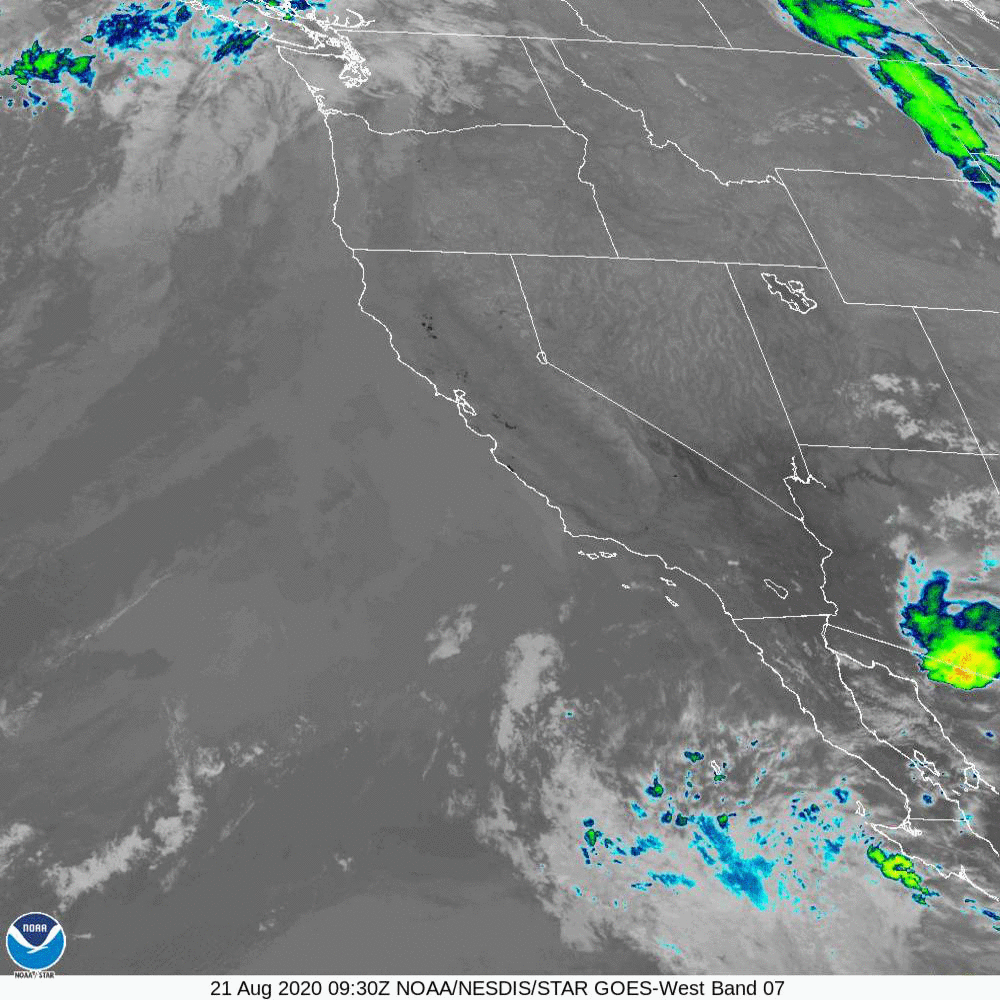
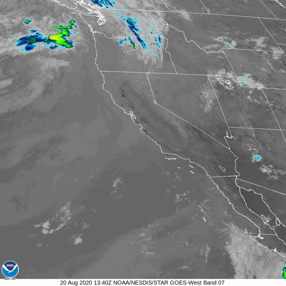
Fig. 2. 72-hour gif of western U.S. satellite imagery.

The mandatory evacuation zones are beginning to recede a bit as the active fires look sparser (figure 1). Thanks to lightning forecasts, we’re not out of the woods.[3]


Tropical Storms

eusgm.gif
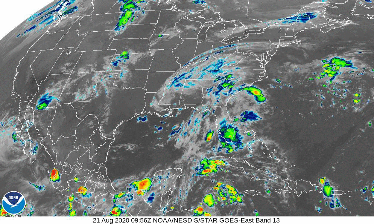
Fig. 3. 72-hour gif of satellite imagery for the Eastern U.S. and Gulf of Mexico.


  1. [1]Michael McGough, “More weekend thunder, lightning in Northern California forecasts stoke wildfire concerns,” Sacramento Bee, August 21, 2020, https://www.sacbee.com/news/weather-news/article245139635.html
  2. [2]Kim Bojórquez, “Why are Black and Latino advocacy groups backing Uber, Lyft in California labor law fight?” Sacramento Bee, August 23, 2020, https://www.sacbee.com/news/politics-government/capitol-alert/article244812707.html
  3. [3]Michael McGough, “More weekend thunder, lightning in Northern California forecasts stoke wildfire concerns,” Sacramento Bee, August 21, 2020, https://www.sacbee.com/news/weather-news/article245139635.html

It might be time to start keeping track of those seven signs of the apocalypse

Tropical Storms

If you think you’re seeing double (figure 1), it’s because you are. I didn’t quite manage to scale the forecast cone map for Marco[1] to line up with the forecast cone map for Laura[2] correctly. It’s only close. Sorry. Marco is also the faint one—I had to reduce the opacity on one image so the other could be seen.
laura-marco-2020-08-23.png
Fig. 1. Forecast zone maps for Tropical Storms Laura[3] and Marco[4] overlaid.

The upshot is that Marco hits first, probably on Monday. Laura follows, probably late Wednesday or early Thursday. Both are forecast to hit roughly the same piece of Louisiana coast as hurricanes.
eusgm
Fig. 2. 72-hour gif of Eastern U.S. and Gulf of Mexico satellite imagery.


Walbridge Fire

FireShot Capture 295 - County of Sonoma Fire Incident Map - sonomacounty.maps.arcgis.com.png
Fig. 3. Screenshot of Sonoma County Fire Incident Map taken by author on August 23, 2020, at 8:41 am EDT (5:41 am PDT).

I don’t think I’d noticed before that the mandatory evacuation zones extend as far south as Guerneville Road, northeast of Graton, but on the other side of Highway 116. Zone 4C1 is mostly vineyards to the south, but includes a lot of the forest I was worried about with Kincade last year.

The good news for the moment is that the active fires seem a bit sparser. The bad news is that lightning projected for tonight.[5]
wus
Fig. 4. 72-hour gif of Western U.S. satellite imagery.

You see that swirling thing off the coast near Santa Barbara (figure 4)? That’d be the culprit.


  1. [1]National Hurricane Center and Central Pacific Hurricane Center, “Tropical Storm Marco,” August 23, 2020, https://www.nhc.noaa.gov/refresh/graphics_at4+shtml/093347.shtml
  2. [2]National Hurricane Center and Central Pacific Hurricane Center, “Tropical Storm Laura,” August 23, 2020, https://www.nhc.noaa.gov/refresh/graphics_at3+shtml/114508.shtml
  3. [3]National Hurricane Center and Central Pacific Hurricane Center, “Tropical Storm Laura,” August 23, 2020, https://www.nhc.noaa.gov/refresh/graphics_at3+shtml/114508.shtml
  4. [4]National Hurricane Center and Central Pacific Hurricane Center, “Tropical Storm Marco,” August 23, 2020, https://www.nhc.noaa.gov/refresh/graphics_at4+shtml/093347.shtml
  5. [5]Michael McGough, “More weekend thunder, lightning in Northern California forecasts stoke wildfire concerns,” Sacramento Bee, August 21, 2020, https://www.sacbee.com/news/weather-news/article245139635.html