Walbridge Fire
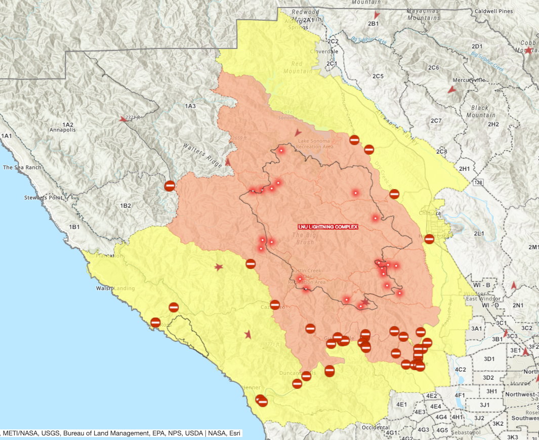
Fig. 1 Screenshot of Sonoma County Fire Incident Map taken by author, August 24, 2012, 9:07 pm EDT (6:07 PDT).
Mandatory evacuation zones continue to recede (figure 1) but the possibility of lightning[1] remains (figure 2).
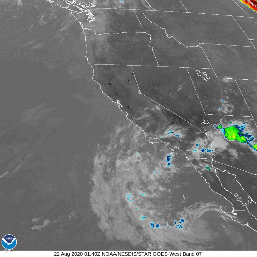
Fig. 2. 72-hour gif of satellite imagery for the western U.S.
The low pressure area responsible for that lightning risk appears to be substantially weakening and centered southwest of Monterey.
Tropical storms
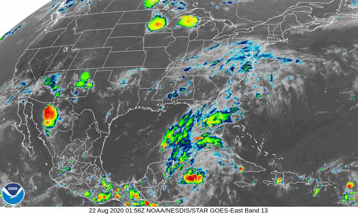
Fig. 3. 72-hour gif of satellite imagery for the eastern U.S. and Gulf of Mexico.
Marco has come ashore in the Florida panhandle and is entering Georgia, seemingly on track for South Carolina, while Laura is pretty close to where Marco was when it entered the Gulf of Mexico (figure 3).
- [1]Michael McGough, “More weekend thunder, lightning in Northern California forecasts stoke wildfire concerns,” Sacramento Bee, August 21, 2020, https://www.sacbee.com/news/weather-news/article245139635.html↩