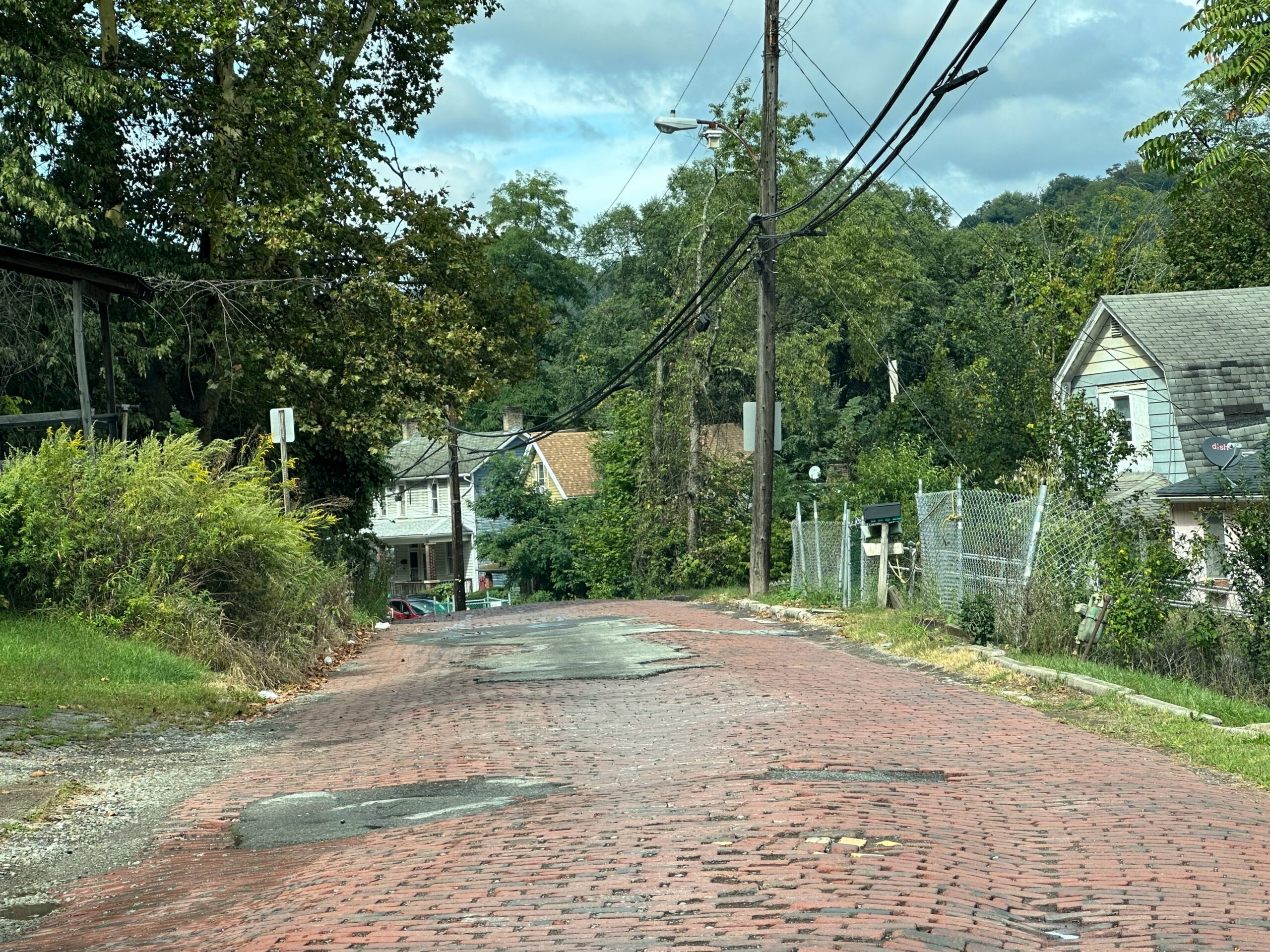
Fig. 1. Prospect Street in East Pittsburgh. Roads like this are more common in poor communities and the photograph cannot do justice to the undulations in the road surface. Photograph by author, September 17, 2023.
In general, local folks will know which roads should be avoided at all costs. Driving for Uber and Lyft, I’ve never had so many folks warn me off of routes that Google Maps recommends because of potholes.
Century III Mall
The biggie near where I live is Century III Mall, which goes by a closed shopping mall.[1] Google Maps, naturally, loves it and thinks you should use this road in nearly every circumstance that it could in any way be appropriate. (In general, Google Maps often prefers roads that are nearly unusable.) Use it at the risk of your car’s suspension; it has so many potholes that, if they (whomever it is that is responsible for this thing) aren’t going to fix it properly, they should close it. Instead, every once in a while, somebody comes around and dumps some asphalt in some of the holes.
East Hills Drive
East Hills Drive between Frankstown Road and Park Hill Drive in the East Hills neighborhood (figure 2) has some of the worst potholes anywhere in Pittsburgh. I haven’t actually gotten out with a tape measure but some of these look to me like they are six inches deep or more. Apparently this roadway has been like this for decades. Unless you have a tank or a bulldozer, avoid this road at all costs.
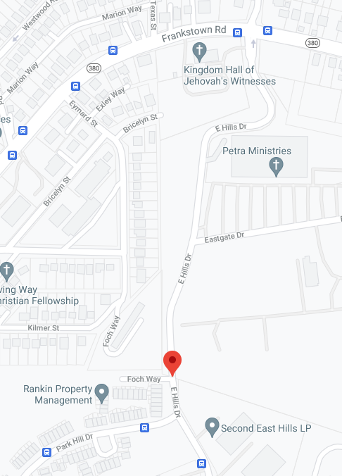
Fig. 2. East Hills Drive. Screenshot by author, June 9, 2021, from Google Maps.
Cobblestone and Brick Streets
Cobblestone and brick streets have notoriously uneven surfaces. Some are effectively as bad as Century III Mall or even East Hills Drive. And any notion that they might be preserved for aesthetic reasons is dispelled when one encounters ugly asphalt patches (example, figure 1) that cover over some of the worst dips.
Well-maintained brick streets are extraordinarily rare; well-maintained cobblestone nearly nonexistent and still a hazard for your car. The rest appear to be kept as brick and cobblestone (I believe the term of art is “high duration surfaces” or something like that) because local authorities feel they can get away without taking care of them. And they can be brutal.
Joncaire Street
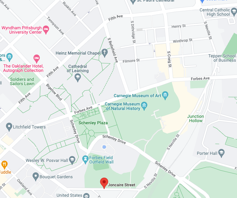
Fig. 3. Screenshot from Google Maps, September 8, 2022, covering the area of a suggested route to avoid Joncaire Street.
One remarkably vicious cobblestone street within the city limits of Pittsburgh is Joncaire (figure 3). Google Maps loves this street as part of a route between the Shadyside neighborhood and Bates Street, which leads to the Parkway.
Google Maps chooses Neville Street to get to Joncaire. Once you’ve gone past Fifth Avenue, Neville descends into a canyon and your only way out is either to turn around or come out on Joncaire.
The trick to avoiding this street from the Shadyside is to turn right on Fifth Avenue, then left on Bigelow Boulevard, which feeds you directly onto Schenley Drive, then right on Roberto Clemente Drive to Bouquet Street. These directions work in reverse, but turn right on Forbes Avenue and then left on Morewood Avenue.
Center Street
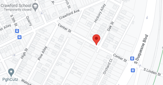
Fig. 4. Screenshot from Google Maps, September 8, 2022.
Even worse than Joncaire is a street on the edge of the city of Duquesne, Center Street (figure 4). This is even more horribly uneven cobblestone with monstrous potholes exceeded only by those on East Hills Drive (see above). Bypassing this road is not easy. If you’re on Crawford Avenue, turn north on South 5th Avenue. If you’re on South Duquesne Boulevard, drive north to Grant Avenue. Both of these routes will be long detours.
If you’re really forced onto Center Street, you can bypass a lot of it with Oak Street, which is still brick, but not nearly as awful.
Utility Holes
In California, they used shims—yes, such things exist and I’ve seen them—to keep utility hole covers even with the level of the pavement. In at least parts of Pennsylvania, including the Pittsburgh area, they just let the covers lie significantly below surface level, effectively creating potholes that are surely just as hard on your suspension as more naturally-created potholes.
Rialto Street
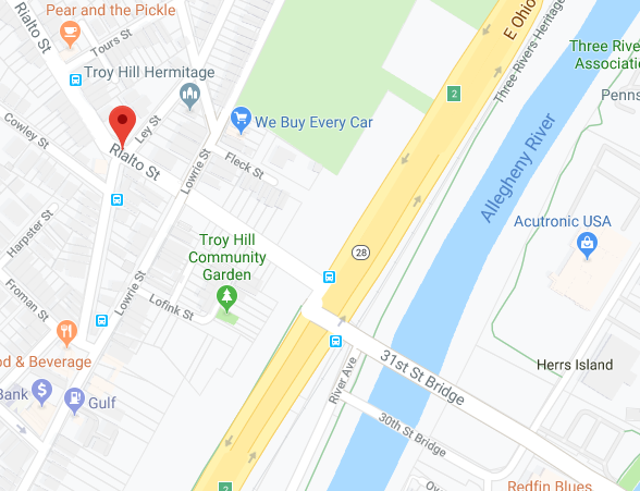
Fig. 5. Screenshot from Google Maps, September 23, 2019. This covers the area around Rialto Street. There are few alternative routes to Troy Hill.
Another problem, harder to avoid, is Rialto Street (figure 5) which effectively connects the 31st Street Bridge over the Allegheny River from the Strip District to Troy Hill. It’s just about the only way to Troy Hill within a reasonable distance. This street is narrow, steep, and, yes, two way. Traffic can be heavy on it because it’s hard to avoid, and getting around that sport utility vehicle (SUV) going the other way is nerve-wracking. And there can be a lot of SUVs here; they’re popular here just like they are anywhere else.
This page is part of a section on driving in Pittsburgh:
- [1]Sam Bojarski, “Century III Mall boarded up; only JCPenney remains,” Pittsburgh Tribune-Review, June 5, 2019, https://triblive.com/local/pittsburgh-allegheny/century-iii-faces-uncertain-future-with-one-tenant-remaining/; Jacob Tierney, “Century III Mall’s JCPenney to close,” Pittsburgh Tribune-Review, August 5, 2020, https://triblive.com/local/pittsburgh-allegheny/century-iii-malls-jcpenney-to-close/↩